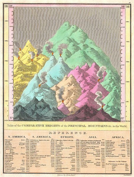
The image is a vintage map titled "Table of the Comparative Heights of the Principal Mountains &c. in the World". It features a stylized, colorful depiction of mountain ranges across different continents. The map itself is a bird's-eye view of mountain ranges, rendered in a somewhat illustrative style rather than a realistic one. The mountains are depicted with jagged peaks and shaded to give a sense of depth. Different colors are used to distinguish mountain ranges on different continents: * **North America:** A range of golden-yellow mountains. * **South America:** A range of light blue mountains. * **Europe:** A range of pink mountains. * **Asia:** A large, prominent range of green mountains. * **Africa:** A range of tan mountains. Each mountain range is labeled with the names of specific peaks and their corresponding heights in feet. The heights are listed in a table below the map, organized by continent. The table is densely packed with text, listing the names of mountains and their heights. The map is framed by a simple border and includes a scale indicating latitude and longitude. The overall aesthetic is that of a 19th-century scientific illustration, with a focus on presenting data in a visually engaging way.