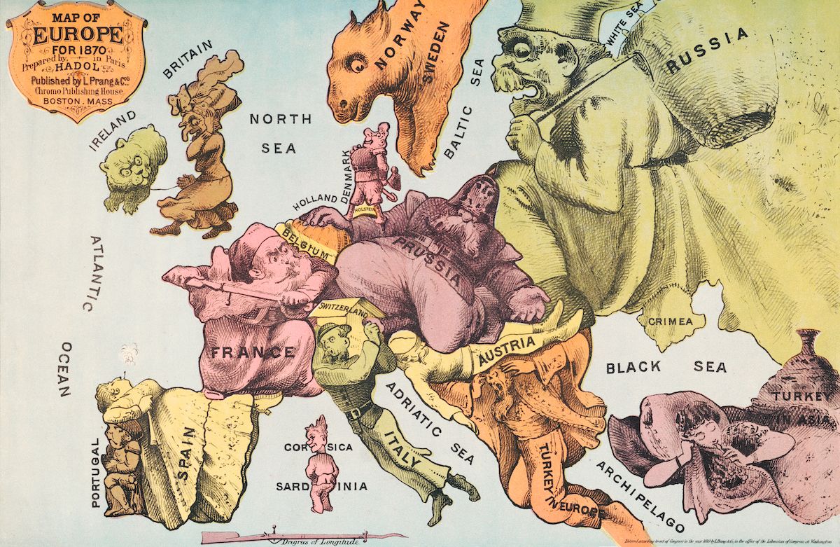
This is a vintage political cartoon map of Europe from 1870. It depicts the countries of Europe as animal caricatures, each representing the perceived national character. **Key Features:** * **Britain:** Represented as a lion, standing guard over Ireland. * **France:** A rooster, prominently displayed. * **Russia:** A large bear, dominating a significant portion of the map. * **Austria:** A multi-headed monster, symbolizing its complex empire. * **Turkey:** A large elephant, positioned in the southeast. * **Spain:** A bull, depicted in the southwest. * **Italy:** A human figure, somewhat smaller in scale. * **Other Countries:** Denmark, Sweden, Holland, Belgium, and Switzerland are also represented as human figures. **Geographical Features:** The map includes various seas (North Sea, Atlantic Ocean, Black Sea, White Sea, Baltic Sea, Adriatic Sea) and islands (Corsica, Sardinia, Crimea, Archipelago). **Text:** The map is titled "Map of Europe for 1870" and includes publisher information: "Prepared by Hadol, Published by L. Prang & Co., Boston, Mass." The overall style is illustrative and satirical, reflecting the political climate of the time. The use of animal caricatures is a common technique in political cartoons to convey stereotypes and opinions about different nations.