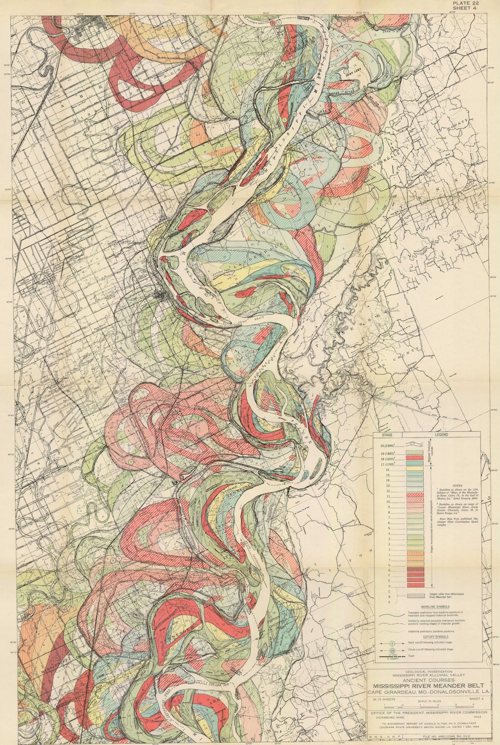
The image is a detailed, vintage map titled "Principal Features Mississippi River, Arkansas, Louisiana, and Missouri". It depicts a winding river (the Mississippi) flowing through a large area of land, with a complex network of tributaries, oxbow lakes, and floodplains. The map is color-coded to represent different elevations and land features. The river itself is shown in shades of blue and white, indicating water flow and depth. Surrounding the river are areas of green, yellow, and brown, representing varying levels of elevation and vegetation. The map also includes a grid system for precise location identification. There's a detailed legend on the right side of the map explaining the color-coding and symbols used. The map is labeled with place names, roads, and other geographical features. The overall impression is of a meticulously crafted document used for studying and understanding the Mississippi River's complex geography and hydrology. The map appears to be from the early to mid 20th century, given its style and color palette.