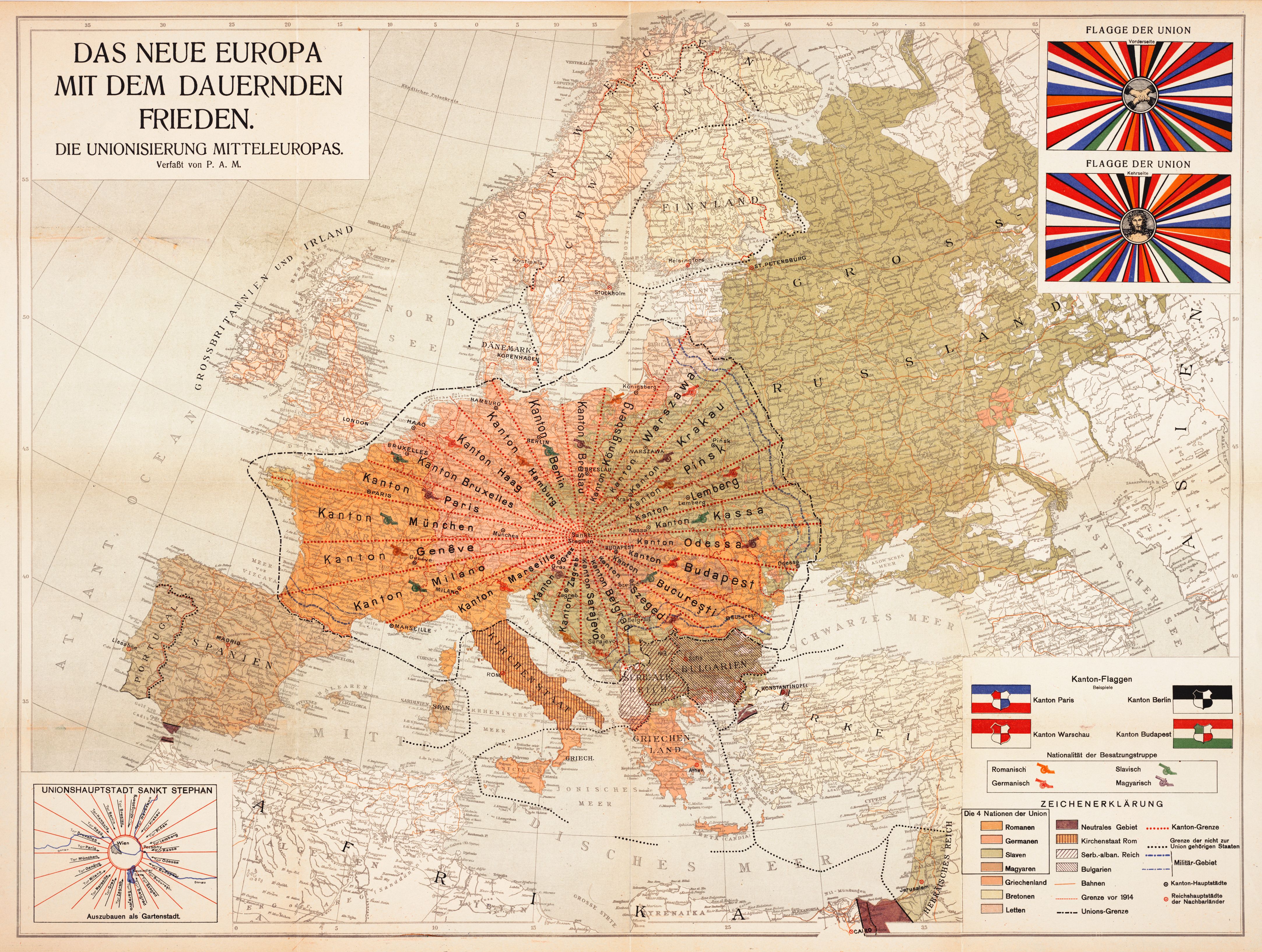
The image is a vintage map titled "Das Neue Europa mit dem Dauernden Frieden" (The New Europe with Lasting Peace), depicting a proposed reorganization of Europe after World War I. It's a political map with a lot of detail and a distinct early 20th-century aesthetic. **Map Details:** The map shows Europe divided into numerous "Kantone" (cantons or districts), each labeled with a city name (e.g., Kanton Paris, Kanton München, Kanton Genf, Kanton Odessa, Kanton Budapest). These cantons are delineated by broken lines, creating a patchwork across the continent. The borders of modern-day countries are largely ignored, replaced by this new cantonal system. * **Color Coding:** The map uses a variety of colors to indicate the dominant language or cultural group within each canton. There's a key (Zeichenerklärung) at the bottom right explaining the color scheme. Colors include shades of orange, green, blue, and yellow. * **Geographical Coverage:** The map extends from Ireland and Great Britain in the west to Russia in the east, and from Scandinavia in the north to the Balkans and parts of North Africa in the south. * **Key Locations:** Major cities are marked, and the map includes geographical features like rivers, mountains, and coastlines. **Flags:** In the upper right corner, there are two flags labeled "Flagge der Union" (Flag of the Union). These flags are circular and feature a central emblem surrounded by radiating lines. The emblems appear to be portraits within a circular frame. **Text and Legend:** * The title is prominently displayed at the top of the map. * There's a small dedication or attribution at the top, likely the name of the map's creator. * The bottom right corner contains a detailed legend (Zeichenerklärung) explaining the color coding and symbols used on the map. * There's also some text at the bottom left, possibly indicating the source or publisher of the map. **Overall Impression:** The map is a fascinating historical artifact, representing a vision of a reorganized Europe after World War I. The cantonal system and the emphasis on language/cultural groups suggest a desire for a more peaceful and stable continent. The map's style and color scheme are typical of early 20th-century cartography. It's a complex and detailed map that would be of interest to historians, cartographers, and anyone interested in the history of Europe. **Additional Notes:** The map appears to be aged, with some discoloration and wear, which adds to its historical charm.