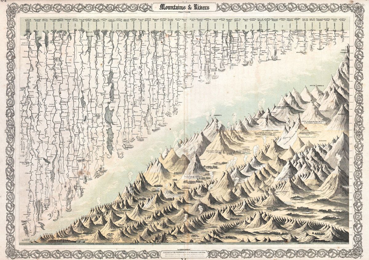
This is a vintage map titled "Mountains & Rivers". It's rendered in a detailed, illustrative style, reminiscent of 19th-century cartography. The map depicts a vast mountainous region intersected by numerous rivers. The mountains are drawn with intricate shading and hatching to create a sense of depth and texture. They are arranged in a series of peaks and valleys, creating a dramatic landscape. The rivers are depicted as winding lines that flow through the mountains, often branching out into smaller streams. Above the mountainous landscape, there's a long row of text, likely listing the names of the mountains and rivers. The text is small and densely packed, arranged in columns. The entire map is framed by an ornate border with a repeating floral or vine pattern. The paper has a slightly aged, yellowish tone, suggesting its age. The overall impression is one of a meticulously crafted and detailed map, likely intended for educational or decorative purposes.