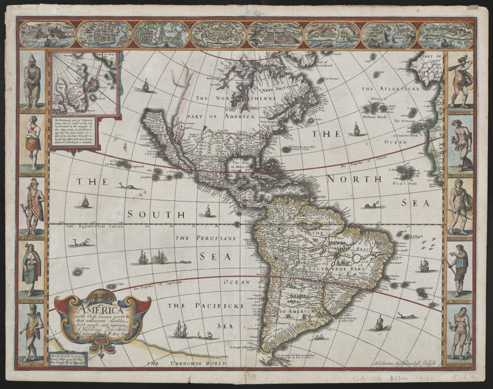
This is a vintage map of the Americas, likely from the 17th or 18th century. The map is a hand-colored engraving on a cream-colored background. It depicts North and South America, along with surrounding oceans and islands. The map is surrounded by a decorative border featuring illustrations of indigenous people, ships, and scenes of life in the Americas. The map itself is detailed, showing coastlines, rivers, and mountains. The names of countries, cities, and geographical features are written in ornate calligraphy. The oceans are filled with illustrations of ships, and the seas are labeled with names like 'The South Sea,' 'The North Sea,' and 'The Pacificke Sea.' The border around the map is divided into sections, each containing a different illustration. These illustrations depict indigenous people in various costumes and activities, as well as scenes of European settlements and trade. There are also small vignettes showing animals, plants, and other natural features of the Americas. The illustrations are rendered in a detailed and realistic style, with vibrant colors and intricate details. Overall, the map is a beautiful and informative piece of cartographic history. It provides a glimpse into the way Europeans viewed the Americas during the age of exploration and colonization.