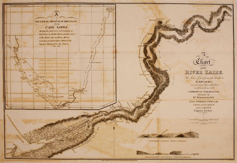
The image shows a vintage map or chart, likely from the 18th or 19th century, with a sepia tone and aged appearance. It's divided into two main sections, side-by-side. The left section is labeled "A GENERAL SKETCH OF THE COAST from CAPE LOPEZ" and depicts a portion of the African coastline. It features a grid pattern of lines, indicating latitude and longitude. The coastline is detailed with small dots representing settlements or landmarks. There are also depictions of mountains and islands along the coast. Text annotations are scattered throughout, likely naming locations or providing descriptions. The right section is labeled "Chart of the RIVER ZAIRE." It shows a winding river, presumably the Congo River (formerly known as the Zaire River), extending inland. The river is the dominant feature, with its course meticulously drawn. Similar to the left section, there's a grid pattern, and small dots mark settlements or points of interest. The river widens as it flows towards the ocean, and there are depictions of islands and coastal features. Both sections share a similar style of cartography, with delicate lines and handwritten annotations. The map appears to be a historical document, likely used for navigation or geographical study. There's a compass rose in the lower right corner of the right section. The overall condition of the map is aged, with some discoloration and wear, adding to its vintage charm.