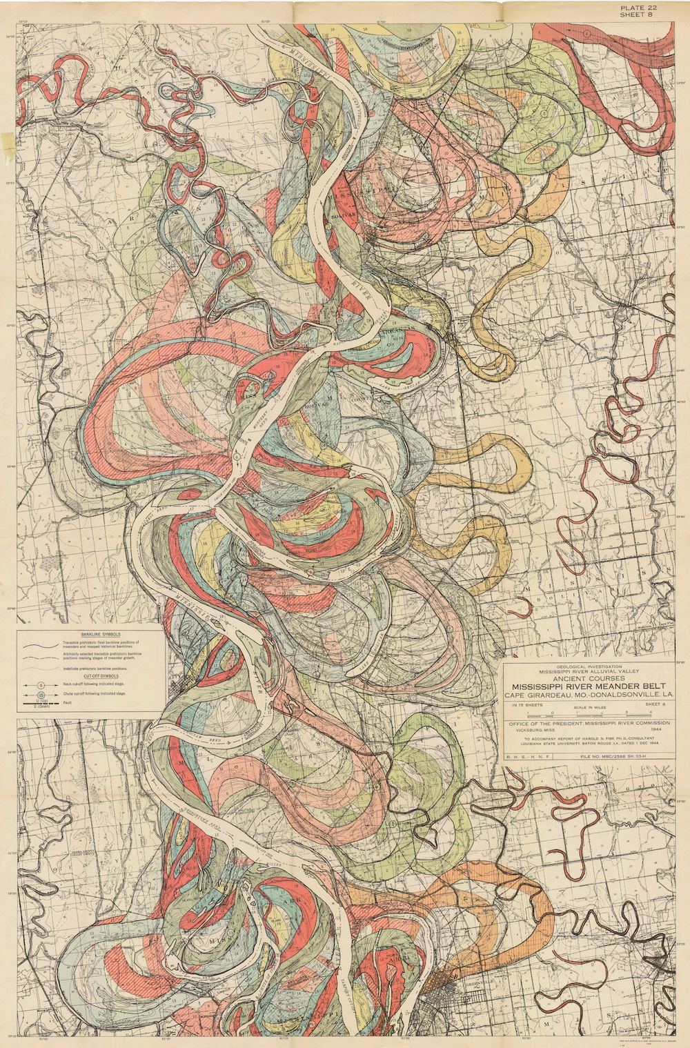
This is a vintage, detailed map depicting the ancient courses of the Mississippi River meander belt, specifically focusing on the area between Cape Girardeau, Missouri, and Memphis, Tennessee. The map is rendered in a faded, sepia-toned aesthetic, giving it a historical feel. The dominant feature is the intricate network of former river channels, represented by a variety of colors. The current river course is shown as a solid, dark line. Surrounding it are numerous loops, curves, and oxbow lakes, indicating the river's past paths. These ancient channels are color-coded, with shades of red, orange, yellow, green, and blue delineating different stages or types of former courses. The map is densely packed with these meanders, creating a complex and almost abstract pattern. There are areas of land interspersed between the river courses, indicated by lighter shades and subtle textures. The map also includes text labels identifying towns, counties, and other geographical features. A legend in the lower left corner explains the color coding and symbols used on the map. A scale is also present, allowing for distance estimation. The overall impression is one of a dynamic landscape shaped by the relentless forces of erosion and deposition. The map is a testament to the river's ever-changing course over time, and a valuable resource for understanding the geological history of the region.