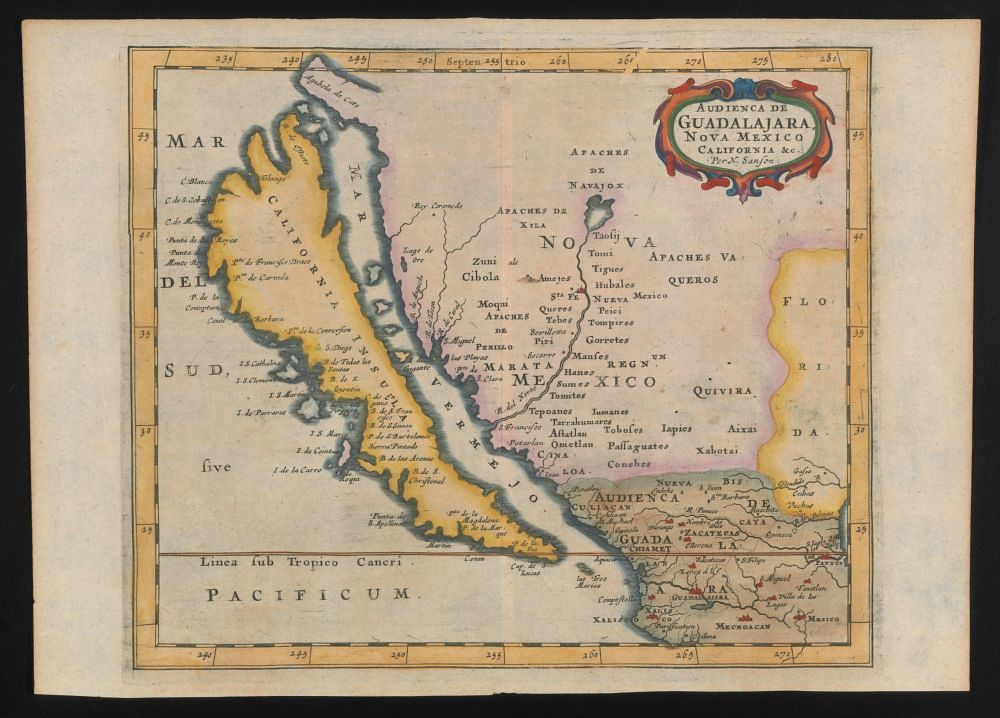
This is a vintage map depicting a region of North America, likely from the 17th or 18th century. The map is rendered in a faded, sepia-toned color palette, giving it an aged appearance. The map's landmass covers a portion of what is now the southwestern United States and northern Mexico. The coastline is irregular and detailed, showing bays, peninsulas, and inlets. The interior is filled with geographical features like mountains, rivers, and settlements, all labeled in Spanish. The map is adorned with decorative elements, including a detailed border with floral motifs and heraldic symbols. A grid of latitude and longitude lines is overlaid on the map, aiding in navigation and location. The map is titled "Audiencia de Guadalajara Nova Mexico" in ornate lettering, indicating the administrative region it represents. Various place names and tribal territories are labeled, providing insights into the historical geography of the area. The map also features a compass rose, indicating the cardinal directions. The ocean is labeled "Pacificum," and a line representing the Tropic of Cancer is drawn across the map. The overall impression is that of a meticulously crafted historical document, offering a glimpse into the cartographic knowledge and colonial ambitions of the time.