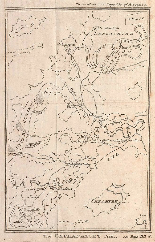
The image is a vintage map, likely from an encyclopedia or historical publication, with a grid pattern overlaid. It depicts a geographical area encompassing parts of Lancashire and Cheshire, with the River Mersey prominently featured on the left side. A canal runs through the center of the map. Several towns and cities are labeled, including Warrington, Chester, and Rixston. A notable feature is a depiction of a hot air balloon, with lines suggesting its path across the landscape. The map is rendered in a detailed, hand-drawn style, with intricate linework representing terrain and waterways. Text labels are scattered throughout, identifying locations and features. The map is titled 'The EXPLANATORY Print' at the bottom, with a reference to 'see Page 1111 d.' at the bottom right. At the top, there's text indicating 'To be placed on Page 150 of Aeropedia'.