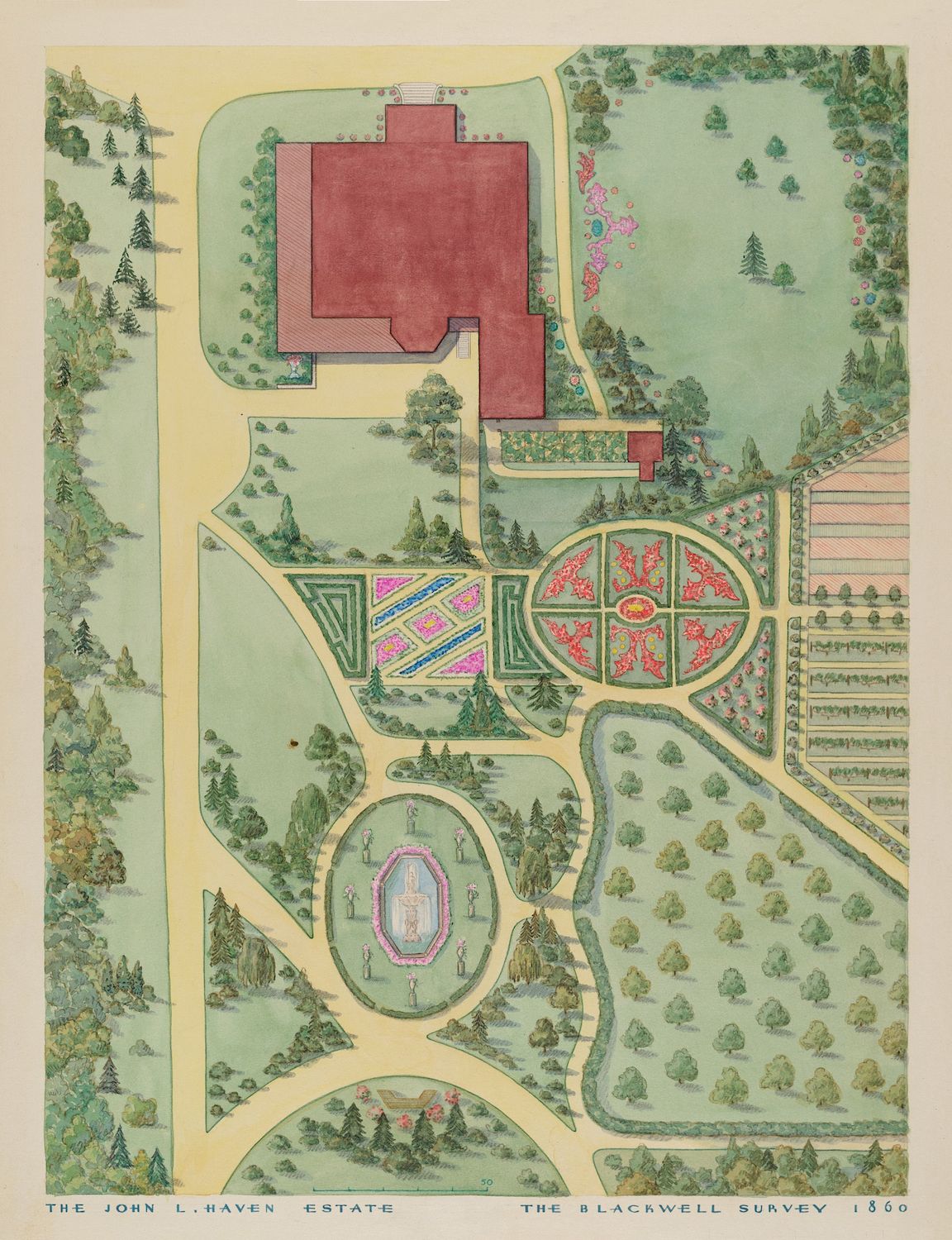
This is a vintage, hand-colored map or survey of the John L. Haven Estate, dated 1860. It's an aerial view of the property, showcasing a meticulously planned landscape. The main building is a large, rectangular structure with a reddish-brown roof, positioned at the top of the map. It's surrounded by a vast, green lawn. Below the building, the landscape transitions into a series of formal gardens. There's a rectangular garden with a colorful, patterned design, followed by a circular garden with intricate floral arrangements. Further down, there's another garden with a more organic, flowing shape, featuring a central pond or water feature. The entire estate is bordered by dense trees, creating a lush, wooded perimeter. Winding paths connect the various gardens and the main building, providing access throughout the property. The map is rendered in a delicate, illustrative style, with attention to detail in the depiction of the plants, trees, and architectural features. The color palette is soft and muted, with shades of green, brown, pink, and purple dominating the scene. At the bottom of the map, there's text identifying the estate and the surveyor, 'The Blackwell Survey'.