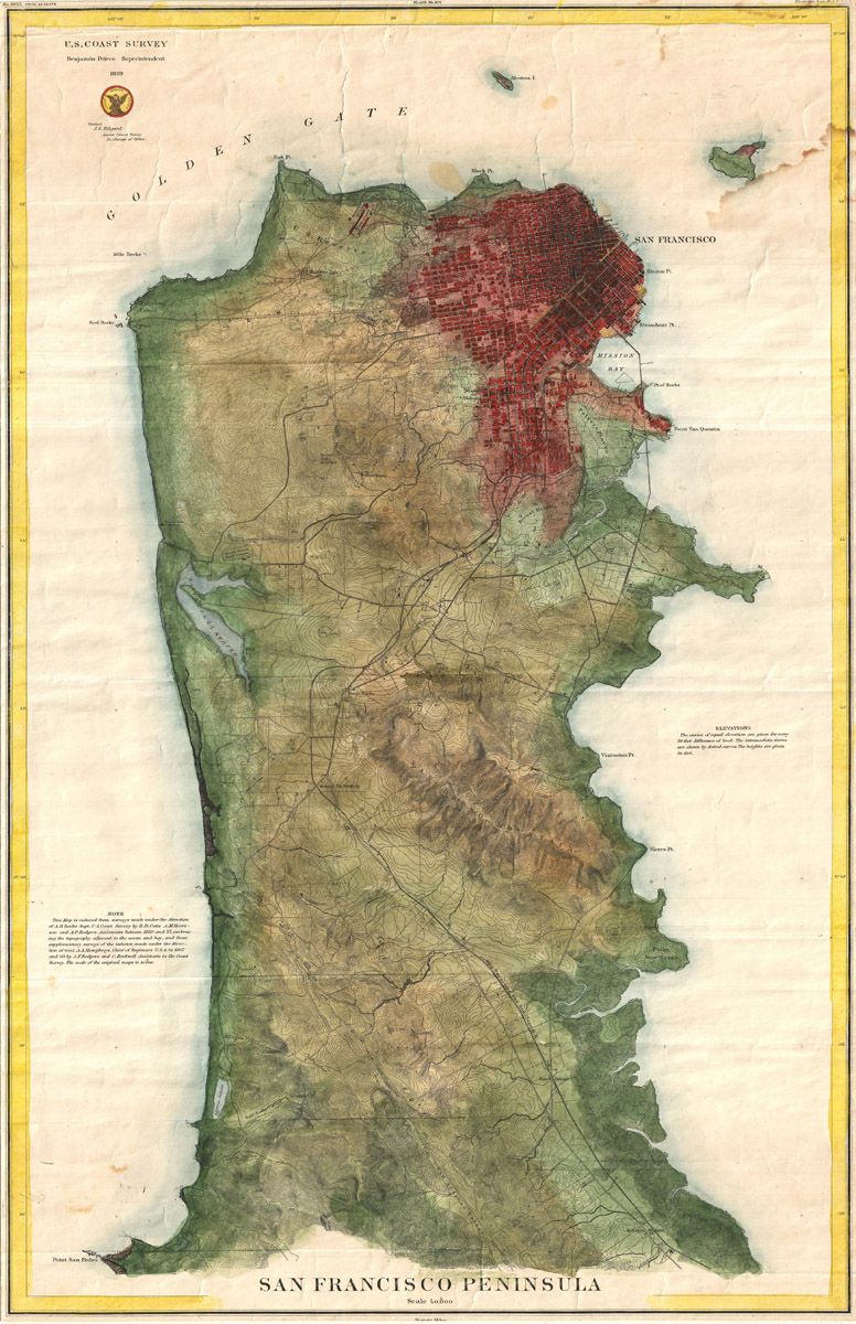
The image is a vintage map of the San Francisco Peninsula, likely from the late 19th or early 20th century. It's a topographical map, showing the land's elevation through hachures (short lines indicating slope). The color palette is muted, with shades of green, brown, and red dominating. The San Francisco Peninsula is the central focus, stretching from roughly the Golden Gate in the north to the southern tip. The city of San Francisco is densely marked in red, indicating urban development. The surrounding areas are mostly green and brown, representing hills, valleys, and open land. Water features prominently, with the Pacific Ocean on the west and San Francisco Bay on the east. The Golden Gate is clearly visible as the entrance to the bay. Numerous smaller bays, inlets, and creeks are also depicted. The map includes text labels identifying various locations, landmarks, and geographical features. There's a title at the bottom reading “San Francisco Peninsula”. A “U.S. Coast Survey” logo is in the upper left corner, along with a date (1878). A legend and scale are present, providing information about the map's symbols and measurements. The map is bordered by a decorative frame, and the overall aesthetic is reminiscent of historical cartography. The map is aged and shows signs of wear and tear, adding to its vintage charm.