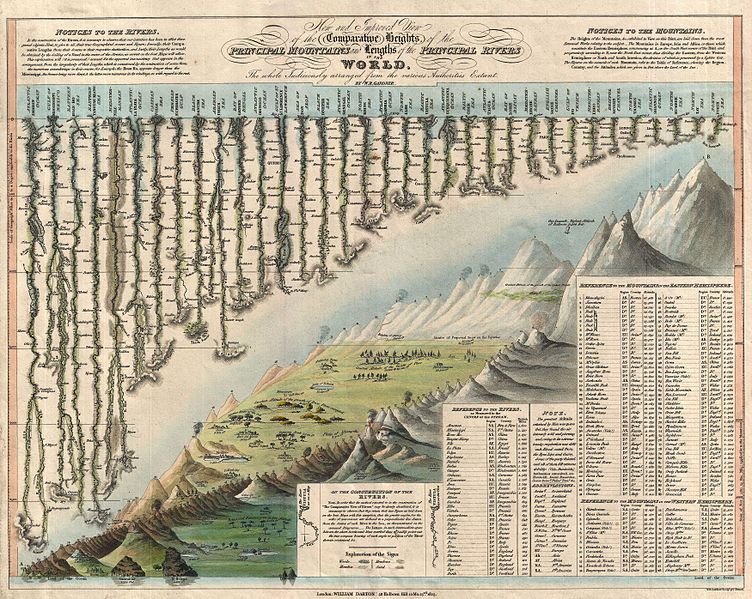
This is a vintage map titled "A Comparative View of the Principal Mountains & Lengths of the Principal Rivers of the World." It's a detailed illustration with a sepia tone, reminiscent of 19th-century cartography. The map features a world outline with a prominent focus on mountain ranges and river systems. The mountains are depicted as shaded, jagged peaks, and the rivers are drawn as winding lines extending from their sources to the ocean. The map includes a table listing the heights of the principal mountains and the lengths of the principal rivers. On the left side of the map, there's a block of text titled "Notice to the Rivers," and on the right, a block titled "Notice to the Mountains." Below the world outline, there's a legend explaining the symbols used on the map. The map is signed by William Darton, a publisher, and dated 1830. The overall style is intricate and detailed, typical of historical maps and illustrations.