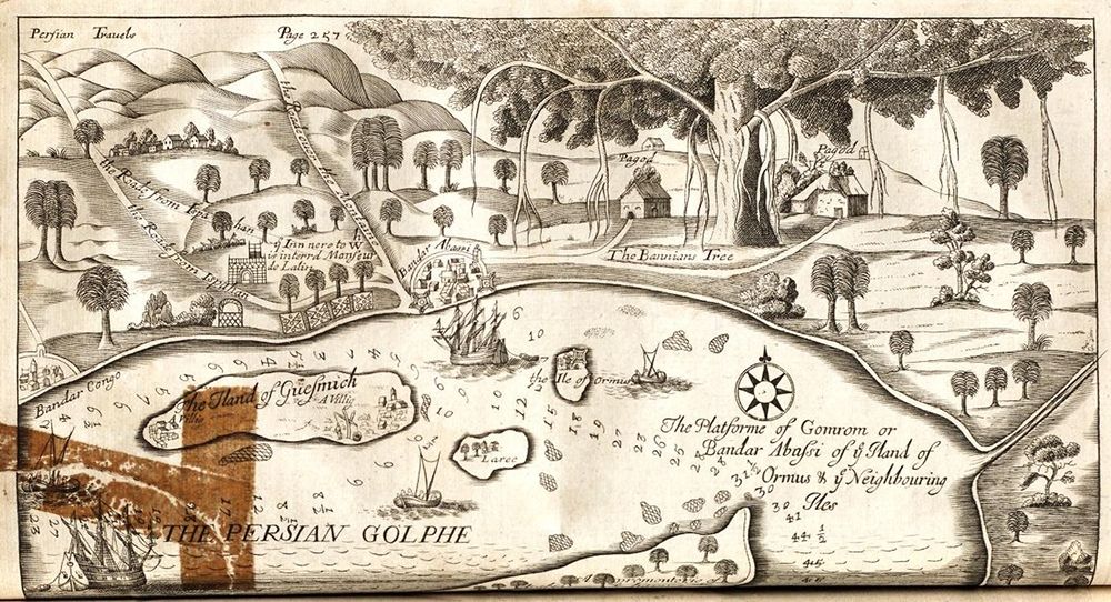
This is a vintage map or illustration depicting a coastal landscape, likely from a historical travelogue or geographical study. The style is reminiscent of 17th or 18th-century cartography, with detailed, somewhat stylized depictions of landforms and vegetation. The scene features a wide body of water, labeled 'The Persian Golphe' in bold lettering at the bottom. Along the water's edge is a coastline with hills and a scattering of buildings, suggesting a town or settlement. Several small islands dot the water, each marked with numbers. Ships are visible sailing in the water, adding to the sense of a bustling port or trade route. The land is covered in dense vegetation, with numerous trees depicted in a somewhat ornamental style. A particularly large and prominent tree is labeled 'The Baunane Tree'. Hills rise in the background, adding depth to the landscape. Text labels are scattered throughout the map, identifying locations such as 'Bander Corg' and 'The Island of Gueshmich'. A compass rose is also present, indicating directions. The overall impression is one of a detailed and historically significant depiction of a coastal region, likely intended for navigational or informational purposes.