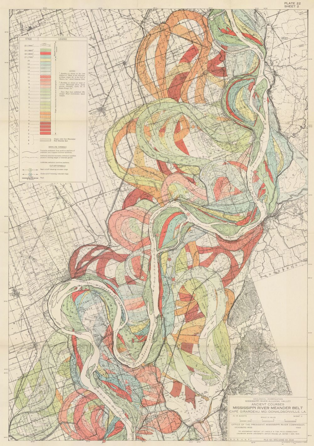
This is a vintage geological map titled "Mississippi River Meander Belt, Louisiana and Mississippi". It's a detailed illustration of the Mississippi River and its surrounding floodplain, showcasing the river's meandering course. The map is rendered in a sepia tone with color coding to indicate different geological features and flood levels. The river itself is depicted as a winding, serpentine line, illustrating its characteristic meanders. The floodplain surrounding the river is filled with various colors, representing different levels of flooding and geological deposits. The color scheme includes shades of yellow, orange, red, and brown, with lighter shades indicating more recent or frequent flooding. The map also features contour lines that depict the topography of the land, showing the elevation changes and the shape of the landscape. There's a detailed legend in the upper left corner that explains the color coding and the different geological features represented on the map. The map is labeled with place names, towns, and other geographical features. The map is titled "Plate 52" and includes a scale for measuring distances. It's a historical map that provides valuable insights into the geological history and the dynamic nature of the Mississippi River and its floodplain. The map is in good condition, with some signs of age and wear.