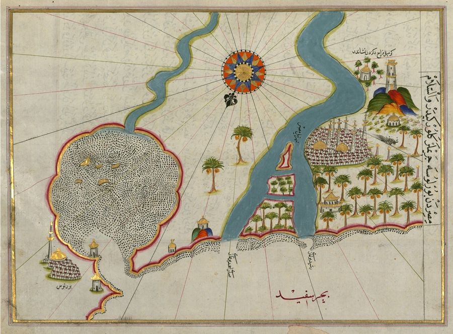
This is a detailed, antique map with a distinctive artistic style. The map depicts a coastline with a large river flowing into it, and a city built along the riverbank. The coastline is irregular and features small bays and peninsulas. The river is wide and winding, and is colored in shades of blue and green. The city is densely populated with buildings, including towers, mosques, and other structures. Palm trees are scattered throughout the city and along the riverbank. The map is decorated with various symbols and illustrations. A large, ornate sun is depicted in the upper center of the map, with rays extending outwards. Small dots are scattered across the map, possibly representing settlements or landmarks. Mountains are depicted along the coastline, and towers are built on the peninsulas. The map is written in an ornate script, with text labeling the various features. The text is written in Arabic or a similar script, and is likely to be a description of the area depicted. The map is drawn on a yellowish-brown background, and the colors are muted and faded, giving it an antique appearance. The overall style of the map is reminiscent of Ottoman or Persian cartography, with its emphasis on artistic detail and symbolic representation.