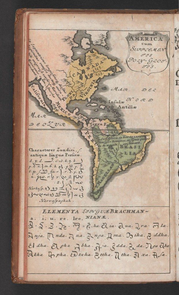
The image is a vintage map of the Americas, with a focus on North and South America, and the Caribbean. The map is rendered in a faded, antique style, with a greenish-brown color palette. The continents are outlined, and various regions are labeled in Latin and other languages. **Map Details:** * **North America:** Shows a somewhat distorted coastline, with California and Mexico labeled. Virginia is also visible. * **South America:** The continent is depicted with a prominent Brazil and a large landmass labeled 'Terra Firma'. * **Caribbean:** The islands of the Antilles are shown as a cluster. * **Ocean:** The surrounding ocean is textured with wavy lines. **Text and Symbols:** Below the map, there are sections of text in what appears to be an ancient script. These sections are labeled: * "Characteres Zundici, & antiqua lingua persica" - This section contains a series of symbols and characters. * "ELEMENTA SANSGUEBRACHMAN" - This section contains a different set of symbols and characters, possibly an ancient alphabet or phonetic system. The overall impression is of a historical document, likely a page from an old book or atlas, combining geographical representation with linguistic or symbolic studies. The colors are faded, and the paper appears aged, adding to the vintage aesthetic.